BCL
Engineer
Not so much the bridge itself, but the location.


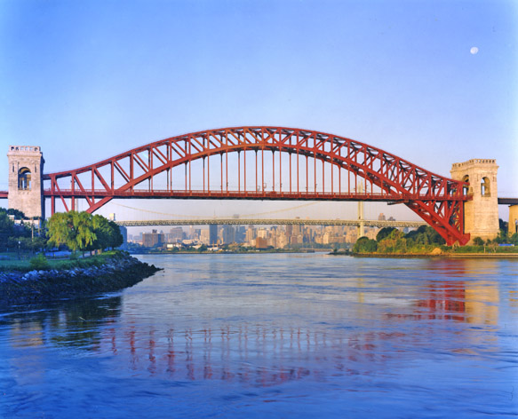
SL/TE use the southern of the two bridges. Also, the river is the Rio Grande, not Pecos. Here is a photo I took from the train crossing the bridges-I have amended the topic name appropriately.<br /><br />What is the bridge that the SSL/TE crosses the Pecos River? In El Paso there are two bridges that cross the Rio Grande near the border. One is a very big bridge span and the other is much more down to earth.

Is that really "photogenic"? The river looks muddy and there some sort of ugly looking factory in the background.SL/TE use the southern of the two bridges. Also, the river is the Rio Grande, not Pecos. Here is a photo I took from the train crossing the bridges-I have amended the topic name appropriately.<br /><br />What is the bridge that the SSL/TE crosses the Pecos River? In El Paso there are two bridges that cross the Rio Grande near the border. One is a very big bridge span and the other is much more down to earth.


That is beautiful. I also enjoyed the Coast Starlight and Empire Builder Photos.I'm new here, so I'm not sure if I can post someone else's photo, but this was posted by someone on Facebook today. It may not be the most beautiful bridge, but it is definitely a photogenic scene. It's the Hawk's Nest Bridge in the New River Gorge in West Virginia.
That is beautiful. I also enjoyed the Coast Starlight and Empire Builder Photos.I'm new here, so I'm not sure if I can post someone else's photo, but this was posted by someone on Facebook today. It may not be the most beautiful bridge, but it is definitely a photogenic scene. It's the Hawk's Nest Bridge in the New River Gorge in West Virginia.
I like this shot from the elevated perspective and with the fall foliage.OK; this pic was on the cover of the Amtrak System Timetable a few years back:
http://www.railpictures.net/viewphoto.php?id=124706
In this particular case, the bridge is more picturesque than the location. In other cases, the location supercedes the beauty of the bridge. Where are the best of both worlds most prevalent?SL/TE use the southern of the two bridges. Also, the river is the Rio Grande, not Pecos. Here is a photo I took from the train crossing the bridges-I have amended the topic name appropriately.<br /><br />What is the bridge that the SSL/TE crosses the Pecos River? In El Paso there are two bridges that cross the Rio Grande near the border. One is a very big bridge span and the other is much more down to earth.
Is that really "photogenic"? The river looks muddy and there some sort of ugly looking factory in the background.

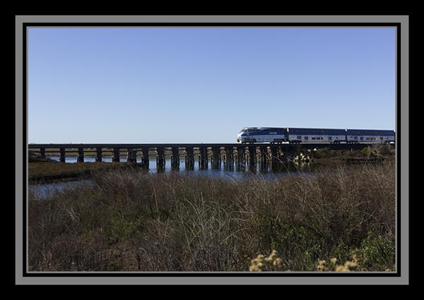
It's even mentioned in the Beach Boys song "Surfin' USA," which I hope you've heard. (When I was your age, I regularly listened to "oldies" radio, which I guess is called "classic hits" these days.)The location of this photo is appropriately named "Trestles" by all locals and is one of the most popular surf spots in SoCal.

Seems like a pretty ordinary-looking deck truss bridge. I know of some bridges used by Amtrak around where I live, but they were pretty ordinary looking and the scenery around the bridge was also nothing spectacular.In this particular case, the bridge is more picturesque than the location. In other cases, the location supercedes the beauty of the bridge. Where are the best of both worlds most prevalent?SL/TE use the southern of the two bridges. Also, the river is the Rio Grande, not Pecos. Here is a photo I took from the train crossing the bridges-I have amended the topic name appropriately.<br /><br />What is the bridge that the SSL/TE crosses the Pecos River? In El Paso there are two bridges that cross the Rio Grande near the border. One is a very big bridge span and the other is much more down to earth.
Is that really "photogenic"? The river looks muddy and there some sort of ugly looking factory in the background.
Note to Eagle: SL/TE does cross the Pecos. NOT in El Paso, where I did correctly mention that those two bridges are over the Rio Grande.
English lesson noted. River corrected. Spellchecker was happy with the town name and so am I. What can I say? I am a civil engineer, not an English teacher. However, I have been known to write reports and specification that seem to have passed muster with the people I did them for.Nice how in the middle of a lecture on terminology he misspells both the name of the river and the name of the town.the Potomac River bridge at Harper's Ferry is most emphatically NOT a trestle.
Not even close to the highest or second or even 12th highest in the world, or the highest in the US. See the list at http://highestbridges.com/wiki/index.php?title=List_of_100_Highest_Railway_Bridges . It does not even appear on the list since it is not high enough, at 84m, to make it. See http://en.wikipedia.org/wiki/Pecos_River_High_BridgeVenture Forth, regarding the bridge over the Pecos River. When I have been on the Sunset Limited the conductor has always alerted us that the bridge is coming and referred to it as the PR High Bridge, adding that it is the highest RR bridge in the US and IIRC the second highest in the world.
The bridge is still there, track-less. I believe SEHSR would reuse it.My personal vote is the former SAL bridge over Lake Gaston on the VA/NC line. Hosted the Silver Star up to 1986 before the line was abandoned by CSX and the train was rerouted thru Rocky Mount.
Enter your email address to join: