You are using an out of date browser. It may not display this or other websites correctly.
You should upgrade or use an alternative browser.
You should upgrade or use an alternative browser.
Rare mileage on the Texas Eagle?
- Thread starter user 1215
- Start date


Help Support Amtrak Unlimited Discussion Forum:
This site may earn a commission from merchant affiliate
links, including eBay, Amazon, and others.
- Status
- Not open for further replies.
George Harris
Engineer
For those knowing what lines were whose in the past, this is the C&EI.
Out of Chicago, double track to Woodland Jct, a few miles south of Watseka, Illinois. This is where the lines to Evansville and St. Louis separate. The line to Evansville was their primary main. It was the route of the Dixie Flyer, Georgian, Humming Bird, and Dixie Flagler. It is now CSX.
The St. Louis side lost passenger service relatively early.
It was and is single track. West of Pana Illinois the line was owned by New York Central and C&EI ran on it by trackage rights. After the Penn Central merger, not sure when, the line was sold to C&EI, or was it MoPac by that time? and the part east of Pana abandoned.
C&EI was merged into Missouri Pacific. As part of that process, the line from Woodland Jct to Evansville was spun off to Louisville and Nashville which is now into CSX.
battalion51
Engineer
It seems like a large portion of the detour route runs parallel to the CN that the CONO and Saluki run on. Why aren't they using the CN for that segment? Did Amtrak get crews qualified on the detour route or are they having to use pilots the whole way?
You'd still have to use the C&EI tracks to get to St. Louis which, as far as I can see, would require backing moves. Gets way to complicated.It seems like a large portion of the detour route runs parallel to the CN that the CONO and Saluki run on. Why aren't they using the CN for that segment?
Pilots most of the way. And a pilot crew change occurs at Villa Grove.Did Amtrak get crews qualified on the detour route or are they having to use pilots the whole way?


$20.99
$27.98
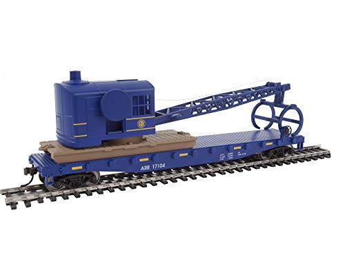
Walthers Trainline HO Scale Model Flatcar with Logging Crane - Alaska Railroad 17104, Blue
Amazon.com


PaulM
Engineer
I believe the former RI went west to Rock Island and Peoria. The regular route is the former Alton Railroad, then GM&O, then Illinois Central Gulf, then Chicago, Missouri, and Western, then Southern Pacific, and finally UP. Did I miss anybody?So the Rock Island Line is nowhere to be used here? Or does the regular route take the former RI?
Is this slow track, or can it handle 79? Also, why not through Decatur & Champaign? Or pick up the Saluki route in Effingham or Mattoon, eliminating the need for Pilots?
And, how can you create Google Maps using rail lines?
And, how can you create Google Maps using rail lines?
Last edited by a moderator:
1) You'll still need pilots to get to St. Louis. The only route to St. Louis for which Amtrak has qualified crews is the normal route through Joliet and Springfield.Is this slow track, or can it handle 79? Also, why not through Decatur & Champaign? Or pick up the Saluki route in Effingham or Mattoon, eliminating the need for Pilots?
And, how can you create Google Maps using rail lines?
2) Operating via another detour would have to deal with other railroads. Except for the shuffle getting out of Chicago (NS, Metra, Belt Railway), the detour is entirely UP. Much simpler this way.
3) With detouring via the CN, even though Amtrak has crews qualified on that route, the current staffing is set up to accommodate three trains per day. Adding a fourth train per day on that route could easily deplete the extra board of qualified crews, causing crew shortages for the Eagle, or for the Illini/Saluki/City of New Orleans. With the chosen detour, you just need the regular CHI-STL crews, plus a couple of UP pilots.
IIRC, most of it was 60. Just a few stretches of 79. ( I had my GPS running which showed the speeds. That's also how I got the route.)Is this slow track, or can it handle 79?
And, how can you create Google Maps using rail lines?
To make custom Google Maps you need a free Google account. That has lots of help files to show how it's done. All of what I did was by hand as my GPS files wouldn't import into Google Maps.
MikefromCrete
Engineer
I agree, Trogdor. This the easiest way to detour the Eagle. Putting it on the CN would just complicate and slow things down as well as mess with the crew rosters. I not sure what kind of connection exists between the CN and UP, it might require some kind of complicated backup move. The UP line is maintained very well for a freight-only route. Since this is a temporary detour, there's no need to stop along the way.1) You'll still need pilots to get to St. Louis. The only route to St. Louis for which Amtrak has qualified crews is the normal route through Joliet and Springfield.Is this slow track, or can it handle 79? Also, why not through Decatur & Champaign? Or pick up the Saluki route in Effingham or Mattoon, eliminating the need for Pilots?
And, how can you create Google Maps using rail lines?
2) Operating via another detour would have to deal with other railroads. Except for the shuffle getting out of Chicago (NS, Metra, Belt Railway), the detour is entirely UP. Much simpler this way.
3) With detouring via the CN, even though Amtrak has crews qualified on that route, the current staffing is set up to accommodate three trains per day. Adding a fourth train per day on that route could easily deplete the extra board of qualified crews, causing crew shortages for the Eagle, or for the Illini/Saluki/City of New Orleans. With the chosen detour, you just need the regular CHI-STL crews, plus a couple of UP pilots.
George Harris
Engineer
From the St. Louis division July 2006 ETT. (This timetable was publicly availabe on a US Govt web site for a while.)
Villa Grove Subdivision: 81st Street Chicago to Villa Grove IL (mileposts 9.0 to 144.6)
Maximum speed limit 60 mph. There is 15 miles limited to 40 mph and 6 miles limited to 20 mph. Two main tracks from milepost 9.0 to milepost 82.4. Single track CTC with four passing tracs of about 2 miles each in the remaining distance. There is also a statement, "Business Trains: Where no permanent or temporary speed restrictions are in effect for freight trains, UPRR passenger trains may operate at 10 MPH above maximum authorized speed for freight trains." Whether this is still true or applies to Amtrak trains, I do not know.
Pana Subdivision: Villa Grove IL to Lenox IL (milepost 144.6 to 275.6)
Maximum speed limit 60 mph. 4 short speed restrictions in the 30 to 50 mph range and 23 miles at 25 mph. Single track CTC with 8 sidings in the 1.6 to 2.0 mile length range. Same statement on Business trains.
At Findlay Junction, milepost 185.5, the line toward the Thebes bridge departs, and with it a lot of the freight traffic.
At Lenox this line joints the regular Amtrak (ex GM&O) route. It is milepost 269.7 via the ex-GM&O, so the detour route is 5.9 miles longer than the regular route. Essentially insignificant.
Preliminary GPS indications are that the current detour is as Grandpa D described.
Amtrak did not pad the schedule, and according to all on board, it takes a full 6 hours to cover that route, not 5 1/2 as indicated in the Time Table.
I really didn't see why most of this track couldn't be 79 MPH. It's solid, straight and extremely smooth. But we lumbered along at a solid 60 MPH almost the whole way.
had8ley
Engineer
Things were crazy enough when we made the detour for the last Gathering !It seemed like we sat forever for crew changes/pilot changes and the scenery was just flat farm land.Of course we sat where we couldn't even get our bearings or guess where we were. Yes, it is rare mileage but nothing to write home about. Now, if you started out of NOL ran up the L&A and went over the old bridge in Baton Rouge and ran parallel to the Morganza Spillway while it was open that would be mileage worth remembering!
George Harris
Engineer
See my post just above. Speed limits are as defined in the employee timetables. The people to ask are Union Pacific.I really didn't see why most of this track couldn't be 79 MPH. It's solid, straight and extremely smooth. But we lumbered along at a solid 60 MPH almost the whole way.
No dispute. The speed was consistent with the speed limit signage. My point is that this route is certfied only for freight traffic, and if Amtrak is going to use it much during this high speed rail initiative, they should look at getting pax speeds certified for this route.
Long Train Runnin'
Engineer
Things were crazy enough when we made the detour for the last Gathering !It seemed like we sat forever for crew changes/pilot changes and the scenery was just flat farm land.Of course we sat where we couldn't even get our bearings or guess where we were. Yes, it is rare mileage but nothing to write home about. Now, if you started out of NOL ran up the L&A and went over the old bridge in Baton Rouge and ran parallel to the Morganza Spillway while it was open that would be mileage worth remembering!
The only time you know your somewhere is when you roll through the big ol' city of Villa Grove.
George Harris
Engineer
Not trying to be pickey, but "certified" is the wrong word. "Set only for freight traffic" or "defined for freight traffic" would be better. If they chose, the UP could probably put up a set of passenger train speed limits on the line right now, as track meeting FRA standards for 60 mph freight operation permits 80 mph passenger operation. The only reason I say probably is the issue of length of circuit for grade crossing warning signals. There is a minimum defined flashers on and gates down time. If the circuit length is such that a train moving 60 mph is at this time, then a faster speed cannot be operated without modifying the crossing circuits.My point is that this route is certfied only for freight traffic, and if Amtrak is going to use it much during this high speed rail initiative, they should look at getting pax speeds certified for this route.
- Status
- Not open for further replies.
Latest posts
-
-

-

-

-

-
St. Paul, Milwaukee, Chicago Corridor service H2 2024 - 2025
- Latest: chadamfleetrailfan
-