There is one more steepest grade- Angels Flight in Los Angeles. It says approximately 33% grade. Cars are powered by funicular system.
You are using an out of date browser. It may not display this or other websites correctly.
You should upgrade or use an alternative browser.
You should upgrade or use an alternative browser.


Help Support Amtrak Unlimited Discussion Forum:
This site may earn a commission from merchant affiliate
links, including eBay, Amazon, and others.
- Status
- Not open for further replies.
What about the Arch in St. Louis? Thats a pretty steep Ascent also! The Cars actually roll on Wheels on Tracks ( you can tell I know nothing about this area of Rail Mechanics) and as Far as I Know besides Amtrak it's the on ly Federally owned Rail Line in the Country since the Arch is run by the Federal Government IINM? :unsure:
Very much a short-line, short-haul railway ... and yes, the second certified train nut on AU in two days (said with only the greatest respect)... looking good.What about the Arch in St. Louis? Thats a pretty steep Ascent also! The Cars actually roll on Wheels on Tracks ( you can tell I know nothing about this area of Rail Mechanics) and as Far as I Know besides Amtrak it's the on ly Federally owned Rail Line in the Country since the Arch is run by the Federal Government IINM? :unsure:
Austin TX - home of the new UP computer/research center??
As a commercial rated pilot and aircraft engineer, I would like to threepeat this. If altitude is an issue, then your safest journey is on the Texas Eagle/Sunset Limited. If rate of climb is THE issue, then I wouldn't be as concerned. The train certainly gains altitude over a longer period of time than a plane or even a car.Airplane cabins are pressurized to at most 8000', usually somewhat lower, like around 7000'. Moffat tunnel is 9200+ feet. So the statement that the altitude of Moffat tunnel is lower than internal cabin pressure in planes is just utterly wrong. Upon cabin depressurization planes are actually required to immediately come down to an altitude below 8000'.Just remember that the highest altitude on the route of the CZ is at Moffet Tunnel and is between 7,000 and 8,000 feet. This is well below the altitude that a plane's cabin is pressurized at, and you don't use O2 masks on a plane most of the time.
I'm not a doctor, but my advice is not to worry.
My advice is do worry if you have atrial fibrillation. I am not a doctor either, but know a thing or two about heart issues from personal experience. My Mother, when she was alive, needed supplementary Oxygen and trust me it is a really serious life or death matter and not to be taken lightly.
I think the rule for depressurization is 10,000 feet, as that is the requirement for supplemental oxygen for private flying if you are going to be above 10k for over 30 minutes. Above 12,500, you gotta have it all the time. Note that pressure altitude counts, but quick don masks are required for the flight crew, and in many cases, one of the pilots must be on 02 at all times. Night time brings those altitudes down, and operating guidelines by the airlines bring them down further. 8,000 feet is common for airliners as it is the best balance between preventing fatigue and Delta-Pressure between the fuselage and outside.
I knew a corporate pilot once who had an unruly, drunk executive in the cabin. He dialed the pressure altitude up to about 10,000 feet, and his passenger slept soundly for the rest of the journey.
TVRM610
Conductor
What the altitude for the Coast Starlight?
UP actually posts this information on their website (PDF) for pressure-sensitive freight customers. The Coast Starlight reaches 5,122 Feet in Grass Lake, CA, MP 371.25, also known as Black Butte. In Oregon, it doesn't get that high - only 4,885' at Cascade Summit, OR MP 536.84.
This PDF also confirms the 9,289' at Moffat Tunnel in Winter Park, CO.
Note that the highest elevation on their map is 10,221' at Tennessee Pass, CO (no pax trains here).
NOW, to dispell a previous post, the highest elevation on the Sunset Limited is MUCH higher than 2,000'. It's actually 5,078' at Paisano, TX. Interestingly, the LOWEST elevation on Amtrak is on this line in Yuma at an elevation of -205'.
Last edited by a moderator:


$4.00
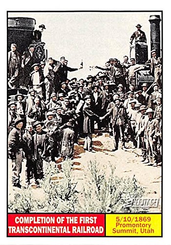
Completion of the First Transcontinental Railroad trading card (Promontory Summit Utah, 5/10/1869) 2009 Topps Heritage #113
Autograph Warehouse (AW Authentic)


$10.37
IA, Iowa Old Vintage Antique Collectables For Sale Illinois Central Railroad Bridge Missouri River 1940
Vintage Postcards - Towns in 50 USA States

$235.99
Pennsylvania Railroad William Atterbury Signed Auto Mounted Cut Index Card D13 - College Cut Signatures
Sports Memorabilia


$10.37
IA, Iowa Old Vintage Antique Collectables For Sale Newton and Northwestern Railroad Bridge Unused
Vintage Postcards - Towns in 50 USA States


$16.99
$22.99
Fodor's Best Road Trips in the USA: 50 Epic Trips Across All 50 States (Full-color Travel Guide)
Amazon.com


$14.99 ($0.30 / Count)
$15.99 ($0.32 / Count)
Yetaha 50PCS Model Trees, Trains Scenery DIY Pine Plastic Model Green Trees for OO HO Scale Railroad Landscape Architecture Scenes, 80mm/3.15"
Yetaha


$20.99
$27.98
Walthers Trainline HO Scale Model Flatcar with Logging Crane - Alaska Railroad 17104, Blue
Amazon.com


$10.37
IA, Iowa Old Vintage Antique Collectables For Sale Illinois Central Railroad Bridge Missouri River Unused
Vintage Postcards - Towns in 50 USA States


George Harris
Engineer
Just got through looking up what VentureForth posted.
For the altitude sensitive, be warned much of the western portion of the CZ is at high elevations. Remember Denver's name, "the mile high city?" That is a mile abouve sea level at the BASE of the mountains. Going west from there, the high points are:
Moffet Tunnel: 9,239
Summit UT (near Provo) 7,440
Hogan,s Tunnel (east of Elko) 5,901
and finally Norden (Donner Pass), 6,887
The old advertizing of the Golden State Route as the low altitude route was somewhat overstated. It was lower, but not that much lower.
Raton Pass on the Southwest Chief route is at 7,834 feet elevation.
But the high elevation on the route of the Golden State Route is 6,726 feet, between Tucumcari NM adn El Paso, so it was only 1,100 feet lower. However, it probably averaged over 1,000 feet lower than the Santa Fe all the way across Arizona and New Mexico, so the difference could well have been significant in those days of traveling without any form of portable oxyogen.
Last edited by a moderator:
Probably the fastest RATE OF CLIMB on the CZ would be the eastbound leg between Rocklin, CA and Colfax, CA, where the track speed for #6 is 50 mph as the train climbs the foothills of the Sierra Nevada. Further east the grade is steeper, but track speed is reduced to 25-30 mph, so your rate of climb is probably less.
Commercial jets may depart sea-level airports at rates as much as 4,000 feet per minute, but the cabin pressurization keeps your effective rate of climb to less than 500 feet per minute.
Commercial jets may depart sea-level airports at rates as much as 4,000 feet per minute, but the cabin pressurization keeps your effective rate of climb to less than 500 feet per minute.
Last edited by a moderator:
Shhh, don't give away trade secrets.I knew a corporate pilot once who had an unruly, drunk executive in the cabin. He dialed the pressure altitude up to about 10,000 feet, and his passenger slept soundly for the rest of the journey.
Tracks at Tennessee Pass, CO have been out of service for many years. But the ex-ROW through the tunnel at the pass is certainly above 10K feet. I have skied many times at the ski resort directly above the tunnel -- a fun little place.UP actually posts this information on their website (PDF) for pressure-sensitive freight customers. The Coast Starlight reaches 5,122 Feet in Grass Lake, CA, MP 371.25, also known as Black Butte. In Oregon, it doesn't get that high - only 4,885' at Cascade Summit, OR MP 536.84.
This PDF also confirms the 9,289' at Moffat Tunnel in Winter Park, CO.
Note that the highest elevation on their map is 10,221' at Tennessee Pass, CO (no pax trains here).
NOW, to dispell a previous post, the highest elevation on the Sunset Limited is MUCH higher than 2,000'. It's actually 5,078' at Paisano, TX. Interestingly, the LOWEST elevation on Amtrak is on this line in Yuma at an elevation of -205'.
In reading a book on the construction of the Moffat Tunnel (too many years ago), but didn't the original route go some 2k feet above the current tunnel elevation, ie, well over 11k' - I remember from the book that that segment and the trying to keep it clear of snow for too many months was the major revenue drain for the route... whereas the tunnel now goes under the shoulder of the 14k' mtn above (don't remember its name), the original route went across/over that shoulder.
My family would regularly go camping in July at the YMCA of the Rockies located between Winter Park and Frasier, CO. Every time we went, we would go up the old railroad ROW up to Coronas/Rollins Pass. One JULY when we went up, there was still 8 feet of snow that they plowed through for vehicle traffic (even though it's not a through route). When I had a Jeep Grand Cherokee, we would go to the other side at the top of the pass and we've seen the old tunnels which are now closed. A guy in a Wrangler actually (intentionally) went down the side and connected to the Eastern side of the pass. Wasn't gonna risk it with my Cherokee & Family. But, yes, even in the dead of Summer, there's been snow up there. Many freestyling skiers go up there, too.
I highly recommend the journey. You can still feel the ties under the roadbed as you come back down the mountain. In fact, I just put the car in 2nd and roll right down the hill. By the time we reach the bottom, everyone is asleep...
I highly recommend the journey. You can still feel the ties under the roadbed as you come back down the mountain. In fact, I just put the car in 2nd and roll right down the hill. By the time we reach the bottom, everyone is asleep...
The Moffat Tunnel burrows under James Peak, elevation 13,301 feet. US Highway 40 crosses the Continental Divide nearby at Berthoud Pass, elevation 11,307 feet.In reading a book on the construction of the Moffat Tunnel (too many years ago), but didn't the original route go some 2k feet above the current tunnel elevation, ie, well over 11k' - I remember from the book that that segment and the trying to keep it clear of snow for too many months was the major revenue drain for the route... whereas the tunnel now goes under the shoulder of the 14k' mtn above (don't remember its name), the original route went across/over that shoulder.
Last edited by a moderator:
jis
Permanent Way Inspector
Staff member
Administator
Moderator
AU Supporting Member
Gathering Team Member
Whenever altitudes are mentioned it strikes me again and again about how high the Himalayas are. I have camped at the base of a valley at the altitude of ~15,000', just across (to the north of) Baralach La Pass where the ostentatiously named National Highway (see Manali - Leh Highway), which at that point is a single lane road that alternates between paved and washed away, crosses the main spine of the Himalaya Range. Further north I spent some time at Khardung La Pass at ~17,600' on my way to Nubra Valley north of Leh. Nubra Valley - all without using any supplementary Oxygen. incidentally has camels that are native to the high plateau which was quite a surprise. Having said that I also comment the Border Road Organization for maintaining that road through an extremely hostile and geologically unstable region with frequent land slides and change of topography as the Himalayas continue to rise at an amazing rate. And the scenery is absolutely breathtaking. It is a life changing experience, and the low level of Oxygen may indeed have something to do with it. ")
Most surprisingly, off and on one hears about plans to build a railway line to Leh. I doubt I will see it in my lifetime. But it will be something, if and when it is built.
Most surprisingly, off and on one hears about plans to build a railway line to Leh. I doubt I will see it in my lifetime. But it will be something, if and when it is built.
Last edited by a moderator:
In the mountain climbing community (see personal profile), there is the old saw: hypoxia can be fun... (of course then turn around and throw up) [personal altitude record is just a few meters over 8000m... well above where hypoxia ceases being "fun".] ... and yes, btwn 16k' and 20k' there is a grittiness that's a bit like being... hypoxic ;-) .Whenever altitudes are mentioned it strikes me again and again about how high the Himalayas are. I have camped at the base of a valley at the altitude of ~15,000', just across (to the north of) Baralach La Pass where the ostentatiously named National Highway (see Manali - Leh Highway), which at that point is a single lane road that alternates between paved and washed away, crosses the main spine of the Himalaya Range. Further north I spent some time at Khardung La Pass at ~17,600' on my way to Nubra Valley north of Leh. Nubra Valley - all without using any supplementary Oxygen. incidentally has camels that are native to the high plateau which was quite a surprise. Having said that I also comment the Border Road Organization for maintaining that road through an extremely hostile and geologically unstable region with frequent land slides and change of topography as the Himalayas continue to rise at an amazing rate. And the scenery is absolutely breathtaking. It is a life changing experience, and the low level of Oxygen may indeed have something to do with it.
Most surprisingly, off and on one hears about plans to build a railway line to Leh. I doubt I will see it in my lifetime. But it will be something, if and when it is built.
jis
Permanent Way Inspector
Staff member
Administator
Moderator
AU Supporting Member
Gathering Team Member
Yeah. I am no mountain climber and would not imagine going to 24'000'+. Around 18,000' was enough hypoxia for me.In the mountain climbing community (see personal profile), there is the old saw: hypoxia can be fun... (of course then turn around and throw up) [personal altitude record is just a few meters over 8000m... well above where hypoxia ceases being "fun".] ... and yes, btwn 16k' and 20k' there is a grittiness that's a bit like being... hypoxic ;-) .
But it was fun after one gets over the initial headache.
Last edited by a moderator:
Swadian Hardcore
Engineer
Those very slow speeds must be why the CZ takes so long to get across the Sierras. Scenic ride, but too slow and expensive. What actual angle of grade is this?Probably the fastest RATE OF CLIMB on the CZ would be the eastbound leg between Rocklin, CA and Colfax, CA, where the track speed for #6 is 50 mph as the train climbs the foothills of the Sierra Nevada. Further east the grade is steeper, but track speed is reduced to 25-30 mph, so your rate of climb is probably less.
Commercial jets may depart sea-level airports at rates as much as 4,000 feet per minute, but the cabin pressurization keeps your effective rate of climb to less than 500 feet per minute.
Yep, US Route 40 is awesome! You make that very shap turn around the edge of a peak then blast up the side! Rode it multiple times on a Greyhound, amazing bus ride, must be among the best in the US! Felt a little woozy while the bus came down slowly, but recovered a lot more quickly than on a plane. Too bad the US Route 550 bus got discontinued.The Moffat Tunnel burrows under James Peak, elevation 13,301 feet. US Highway 40 crosses the Continental Divide nearby at Berthoud Pass, elevation 11,307 feet.In reading a book on the construction of the Moffat Tunnel (too many years ago), but didn't the original route go some 2k feet above the current tunnel elevation, ie, well over 11k' - I remember from the book that that segment and the trying to keep it clear of snow for too many months was the major revenue drain for the route... whereas the tunnel now goes under the shoulder of the 14k' mtn above (don't remember its name), the original route went across/over that shoulder.
Last edited by a moderator:
George Harris
Engineer
2.2%Those very slow speeds must be why the CZ takes so long to get across the Sierras. Scenic ride, but too slow and expensive. What actual angle of grade is this?Probably the fastest RATE OF CLIMB on the CZ would be the eastbound leg between Rocklin, CA and Colfax, CA, where the track speed for #6 is 50 mph as the train climbs the foothills of the Sierra Nevada. Further east the grade is steeper, but track speed is reduced to 25-30 mph, so your rate of climb is probably less.
Commercial jets may depart sea-level airports at rates as much as 4,000 feet per minute, but the cabin pressurization keeps your effective rate of climb to less than 500 feet per minute.
Swadian Hardcore
Engineer
Thanks. That seems pretty steep for an Amtrak train. What's the steepest on the system?2.2%Those very slow speeds must be why the CZ takes so long to get across the Sierras. Scenic ride, but too slow and expensive. What actual angle of grade is this?Probably the fastest RATE OF CLIMB on the CZ would be the eastbound leg between Rocklin, CA and Colfax, CA, where the track speed for #6 is 50 mph as the train climbs the foothills of the Sierra Nevada. Further east the grade is steeper, but track speed is reduced to 25-30 mph, so your rate of climb is probably less.
Commercial jets may depart sea-level airports at rates as much as 4,000 feet per minute, but the cabin pressurization keeps your effective rate of climb to less than 500 feet per minute.
The old railroad line that I was talking about was Coronas Pass which unfortunately is no longer traversable (though I think there have been plans to reconnect Coronas Pass Road to Rollins Pass Road in the future... 11,300' in elevation for a Railroad where a whole town existed back until 1928...The Moffat Tunnel burrows under James Peak, elevation 13,301 feet. US Highway 40 crosses the Continental Divide nearby at Berthoud Pass, elevation 11,307 feet.In reading a book on the construction of the Moffat Tunnel (too many years ago), but didn't the original route go some 2k feet above the current tunnel elevation, ie, well over 11k' - I remember from the book that that segment and the trying to keep it clear of snow for too many months was the major revenue drain for the route... whereas the tunnel now goes under the shoulder of the 14k' mtn above (don't remember its name), the original route went across/over that shoulder.
This is the route to the north of Moffat Tunnel that one can find on the Google satellite imagery which appears to be CO SR 117. Looking at the long sweeping bends and the searching for reasonable grades, one could easily see it as an old RR route. My question was mostly to do with if the old pre-1928 route over the top was the one to the north of the tunnel that one finds in the imagery, or the one to the south that one also finds. Sounds like it was the one to the north... though it would be interesting to understand the southerly route, in that it also exhibits the same sweeping terms and attempts at gradual gradients - was it ever a serious route, or an attempt and then abandoned in favor of the more northerly one, and that abandoned in favor of the tunnel. Personally I find history to be a rich and enjoyable source of personal edification.The old railroad line that I was talking about was Coronas Pass which unfortunately is no longer traversable (though I think there have been plans to reconnect Coronas Pass Road to Rollins Pass Road in the future... 11,300' in elevation for a Railroad where a whole town existed back until 1928...The Moffat Tunnel burrows under James Peak, elevation 13,301 feet. US Highway 40 crosses the Continental Divide nearby at Berthoud Pass, elevation 11,307 feet.In reading a book on the construction of the Moffat Tunnel (too many years ago), but didn't the original route go some 2k feet above the current tunnel elevation, ie, well over 11k' - I remember from the book that that segment and the trying to keep it clear of snow for too many months was the major revenue drain for the route... whereas the tunnel now goes under the shoulder of the 14k' mtn above (don't remember its name), the original route went across/over that shoulder.
many thanks for the reply - greg
- Status
- Not open for further replies.