Various short trips around the Willamette Valley

Amtrak Unlimited Discussion Forum

Help Support Amtrak Unlimited Discussion Forum:

This site may earn a commission from merchant affiliate links, including eBay, Amazon, and others.
Thanks for posting the thread. Interesting. However, on the down side, it would eliminate my favorite segment of the Coast Starlight route, from Klamath through the lower Cascades to Eugene. Traveling in the early morning northbound and around sunset southbound.

Well, I think that even if it does happen, it is going to be quite a few years before Amtrak changes their route through here. I mean, if Amtrak is going to make any service changes in Oregon, it is going to be the low-hanging fruit of more trains and station improvements before they undertake a gigantic engineering project.
 
Well, I think that even if it does happen, it is going to be quite a few years before Amtrak changes their route through here. I mean, if Amtrak is going to make any service changes in Oregon, it is going to be the low-hanging fruit of more trains and station improvements before they undertake a gigantic engineering project.
I've written about it before, but in brief, when I worked at ODOT I had access to the SP engineering diagrams and operating timetables and a Coast Starlight equivalent would have been five hours slower on the 19th Century Siskiyou Line than on the 20th Century Cascade Line.
 

This is kind of stretching the purpose of this thread, because this is more about the history of rail and transit in a city, but it still "involves rail transit" in that I show the train station, and how it relates to the surrounding community.
This is about Albany, Oregon, which is the smallest city in Oregon on the Cascades corridor. While most cities in the Willamette Valley switched to services or high-tech economies, Albany is still based around old industry---timber and metals. It also have major freight yards.
Before World War II, it seems the train track (and the Amtrak station) would have been at the eastern end of the city. After World War II, the city sprawled out to the east, creating two disconnected towns: an old downtown, full of brick buildings, and small city blocks to the west of the tracks, and then a sprawl of highways and big box retail to the east.
As far as train travel goes, this makes Albany a bit difficult, especially if the Cascades tries to become a more regular commuter service. In Eugene, you can hop off of the Amtrak Cascades and be immediately surrounded by dining, entertainment, and also offices. As well as local transit routes that work regularly. But if you hop off of the Amtrak Cascades in Albany, you have freight yards to one side and a highway to the other.
 

This is kind of stretching the purpose of this thread, because this is more about the history of rail and transit in a city, but it still "involves rail transit" in that I show the train station, and how it relates to the surrounding community.
This is about Albany, Oregon, which is the smallest city in Oregon on the Cascades corridor. While most cities in the Willamette Valley switched to services or high-tech economies, Albany is still based around old industry---timber and metals. It also have major freight yards.
Before World War II, it seems the train track (and the Amtrak station) would have been at the eastern end of the city. After World War II, the city sprawled out to the east, creating two disconnected towns: an old downtown, full of brick buildings, and small city blocks to the west of the tracks, and then a sprawl of highways and big box retail to the east.
As far as train travel goes, this makes Albany a bit difficult, especially if the Cascades tries to become a more regular commuter service. In Eugene, you can hop off of the Amtrak Cascades and be immediately surrounded by dining, entertainment, and also offices. As well as local transit routes that work regularly. But if you hop off of the Amtrak Cascades in Albany, you have freight yards to one side and a highway to the oth


This is kind of stretching the purpose of this thread, because this is more about the history of rail and transit in a city, but it still "involves rail transit" in that I show the train station, and how it relates to the surrounding community.
This is about Albany, Oregon, which is the smallest city in Oregon on the Cascades corridor. While most cities in the Willamette Valley switched to services or high-tech economies, Albany is still based around old industry---timber and metals. It also have major freight yards.
Before World War II, it seems the train track (and the Amtrak station) would have been at the eastern end of the city. After World War II, the city sprawled out to the east, creating two disconnected towns: an old downtown, full of brick buildings, and small city blocks to the west of the tracks, and then a sprawl of highways and big box retail to the east.
As far as train travel goes, this makes Albany a bit difficult, especially if the Cascades tries to become a more regular commuter service. In Eugene, you can hop off of the Amtrak Cascades and be immediately surrounded by dining, entertainment, and also offices. As well as local transit routes that work regularly. But if you hop off of the Amtrak Cascades in Albany, you have freight yards to one side and a highway to the other.

I enjoyed the video. I get a magazine called "Northwest Travel and Life" which covers popular travel destinations in the Northwest. A few years ago the magazine had an article on Albany. OR:

https://is.gd/74bSzJ
It looks like a fun town to visit. Especially for sampling food from local farms; fruits and veggies.
 
I checked a streetcar map for Albany and almost the entire town in that era was between the SP tracks and the Willamette River. River traffic was likely a consideration. The streetcar ran from the SP Depot via Lyon Street to First Avenue, a block from the river and was controlled by the SP. However, the OE was still able to get into Albany in 1912. In 1918 the streetcar was shut down and a decade after the OE reached Albany its passenger service was doomed by completion of the Pacific Highway (US99E).

1912 07 03 - Oregonian - OE reaches Albany.jpg
 

Usually I take the Amtrak Cascades or just a bus, but this weekend, for a multiple-day trip, I took the Coast Starlight. Unfortunately, in December, and being two hours late, what I saw of the Willamette Valley between Albany and Vancouver was mostly shadowy. Also, a lot of the places that the railroad tracks pass through are the type of places that railroad tracks pass through---lots of warehouses and sheds and autoyards, etc, which can be a disappointment after all the scenery between Redding and Eugene.
In this video, I say that while I can usually find some sort of point or conclusion, in this case, I just took the train and reached my destination. Maybe it is getting too late in the year to be smart? :)
 
An added note about the Salem and Woodburn service: since you launched this series, Greyhound Lines has discontinued service to Salem, abandoning the charming station built for them by ODOT. Now all I-5 trips stop in Woodburn.

Flixbus runs only PDX<>SLM<>CVI<>EUG once a day, so Amtrak at SLM with three daily trains each way and five daily Thruway buses each way is the major carrier in the capital city.
Yep, we talked about that on the last page. Without really finding out a reason why.
 
I haven't been to the northernmost coast this year, but I probably should go.
For travellers, the buses to the northcoast are more integrated with the Amtrak system, and more geared towards tourists. So the bus from Union Station to Astoria has all the luggage handling of any Amtrak thruway route. There is also going to be a lot more tourist friendly options once you get to the station---so if someone is taking the Coast Starlight and wants to see the Oregon Coast, going to Astoria/Cannon Beach/Seaside is probably the best option.
The Oregonian website has a positive article about a family trip by transit and intercity bus from Portland to Cannon Beach.

https://www.oregonlive.com/travel/2...ree-family-mini-vacation-to-cannon-beach.html
 
Sometimes they've temporarily discontinued service while changing agents or stop locations, which is why I re-checked their information. It's been going on for long enough to seem "permanent".
Ah, okay. Sorry for doubting that you were on the ball! :)
The reasons for such a decision still seem pretty mysterious to me, although I imagine it might be either about the time required to get off of/onto the freeway, or it might have been about security maintenance at the station.
 
I posted this one in the Portland MAX thread, talking about its impact on local transportation, but here it is to talk about the Amtrak Cascades:


Vancouver, Washington Amtrak is the most difficult train station for travellers. It is in a railroad wye, with three railroads tracks to cross to get out of it. Immediately outside of that is a warehouse district, and then after crossing through a governmental complex, you would be in downtown.
This is a great contrast to Eugene, for example, where you literally have 100 feet between the doors of the Amtrak station and a bar, and where you are basically right in the entertainment district.
What this means for travellers is that if you are getting off or getting on, or if your train unfortunately has a delay and is stuck at a station---in a city like Eugene, you can actually go out and do something fun. In Vancouver, if you had to wait...you would be waiting in the middle of a warehouse district.
Here is a list, from my experience, of how easy it is to access things from the Amtrak Station:

1. Eugene -- super easy and fun
2. Albany -- a short walk to downtown, one difficult underpass to cross
3. Salem -- pretty close to the state capital and downtown
4. Portland -- right next to light rail, close to some restaurants, can be a bit of a sketchy neighborhood at times
5. Vancouver -- as seen, pretty bad
6. Kelso/Longview -- I've never gotten off here, it seems pretty medium
7. Centralia -- Right in the middle of a downtown area with dining
8. Oympia -- Not actually in Olympia, like 10 miles from downtown Olympia
9. Tacoma -- In a railroad district, but there is some stuff around
10. Seattle -- In downtown Seattle, but kind of on the edge of town
 
I have some plans, next summer, for a trip to Whitefish, MT. My plan is to fly to Portland then pick up the Empire Builder for the trip to Whitefish. However, because of the "sketchy neighborhood", as you put it, with panhandlers and homeless about, I was thinking of leaving from Vancouver, WA instead.
I have discovered, however, that Vancouver, WA is a flag stop for the Empire Builder, and that Vancouver doesn't take checked baggage if you depart on the Builder. Is this so? Maybe it would be easier to leave from Union Station, in Portland, and hope I don't get hit up for money by the local street folk and the neighborhood around the station isn't as bad as some reports say it is.

Something I don't understand. Why is a large city like Vancouver, WA a flag stop for the Empire Builder? I also made an inquiry and found that the Vancouver station, indeed, doesn't take checked baggage if you are taking the Empire Builder. I believe Vancouver isn't a flag stop and will let you check baggage if you are taking the Coast Starlight.

I am also wondering, as the EB doesn't have a dining car, if the boxed meal is palatable or if it would be better to take along a sandwich.
 
Last edited:
Boarding in Vancouver you'll miss crossing the Willamette River and the Columbia River. On the other hand, it's pretty mellow. Portland is busy at the time for Train 28. Just allow for a delay in case you have to wait for a freight on the non-passenger side of the wye.

When I was a kid, the SP&S Rwy. guys used to let me behind the ticket counter and into the telegraph office. There is no longer a telegraph office, but I have the impression that the Amtrak agents are still less stressed than in PDX.
 
Must have been fun to see the telegraph office. I have spoken, in the past, with at least one ham operator who used to work as a railroad telegraph operator He said it took some time to lean to copy from those old sound boxes ("railroad code") as he called it. I am trying to think; there might have been a display of an old telegraph desk at the railroad depots at Lake Louise, AB and at Glenwood Springs, CO. but I'm not sure.


G

Going back to the question of why is the Vancouver station a regular stop for the Coast Starlight and only a flag stop for the Empire Builder. I wonder if the reason has something to do with the fact that Coast Starlight and Cascades passengers board from the Northwest side of the station while Empire Builder passengers board from the Southeast side of the station? Viewing Mr. Fish's video, the Vancouver station doesn't seem to be user friendly.
 
Last edited:
Must have been fun to see the telegraph office. I have spoken, in the past, with at least one ham operator who used to work as a railroad telegraph operator He said it took some time to lean to copy from those old sound boxes ("railroad code") as he called it. I am trying to think; there might have been a display of an old telegraph desk at the railroad depots at Lake Louise, AB and at Glenwood Springs, CO. but I'm not sure.


Going back to the question of why is the Vancouver station a regular stop for the Coast Starlight and only a flag stop for the Empire Builder. I wonder if the reason has something to do with the fact that Coast Starlight and Cascades passengers board from the Northwest side of the station while Empire Builder passengers board from the Southeast side of the station? Viewing Mr. Fish's video, the Vancouver station doesn't seem to be user friendly.
Yes, I started back then to learn Morse code, but got so interested in photography that I never followed up. There was a telegrapher's club in Portland that met in the Mallory Hotel and would set up a circuit and chit chat in code. The Vancouver station was a busy place due to the junction, but also because trains on the Tacoma line were under the NP dispatcher in that city, so new train orders had to be issued in each direction. (The line between Vancouver and Portland was the SP&S.) I also spent time at Willbridge, where I could watch the CTC board from outside of the station.

In a 2016 PRINTED timetable, the only flag stop on the Builder was at Essex. And Vancouver was shown as having checked baggage service.
 
I have some plans, next summer, for a trip to Whitefish, MT. My plan is to fly to Portland then pick up the Empire Builder for the trip to Whitefish. However, because of the "sketchy neighborhood", as you put it, with panhandlers and homeless about, I was thinking of leaving from Vancouver, WA instead.
I have discovered, however, that Vancouver, WA is a flag stop for the Empire Builder, and that Vancouver doesn't take checked baggage if you depart on the Builder. Is this so? Maybe it would be easier to leave from Union Station, in Portland, and hope I don't get hit up for money by the local street folk and the neighborhood around the station isn't as bad as some reports say it is.

Something I don't understand. Why is a large city like Vancouver, WA a flag stop for the Empire Builder? I also made an inquiry and found that the Vancouver station, indeed, doesn't take checked baggage if you are taking the Empire Builder. I believe Vancouver isn't a flag stop and will let you check baggage if you are taking the Coast Starlight.

I am also wondering, as the EB doesn't have a dining car, if the boxed meal is palatable or if it would be better to take along a sandwich.
I was on vacation (many videos coming soon!) so I didn't have access to a computer and couldn't answer this.
A picture is worth a thousand words, so a video is worth thousands of words, and here is a video of The Fields Park in Portland, about four or five blocks from Union Station:

Right in the sketchiest part of downtown Portland, we have families and people of all ages having fun and walking their dogs seemingly without a care.
But of course, a traveller who might be tired and encumbered by baggage might be a lot more vulnerable than people familiar with the neighborhood.
But personally, it seems like a lot more effort to go to Vancouver to avoid sketchiness...when Union Station itself, if you stay inside, is very safe and comfortable, and when the Vancouver station is not exactly the most charming and safe location either.
 
Last edited:
I was on vacation (many videos coming soon!) so I didn't have access to a computer and couldn't answer this.
A picture is worth a thousand words, so a video is worth thousands of words, and here is a video of The Fields Park in Portland, about four or five blocks from Union Station:

Right in the sketchiest part of downtown Portland, we have families and people of all ages having fun and walking their dogs seemingly without a care.
But of course, a traveller who might be tired and encumbered by baggage might be a lot more vulnerable than people familiar with the neighborhood.
But personally, it seems like a lot more effort to go to Vancouver to avoid sketchiness...when Union Station itself, if you stay inside, is very safe and comfortable, and when the Vancouver station is not exactly the most charming and safe location either.

Thanks for the information. Portland has vowed to clean up its homeless camps. Hopefully they will.

https://is.gd/f2rJNx
A suggestion, in the above link, for taking Uber or Lyft to and from the station. Is that a good idea? Is there an absence of taxi's in front of the station?

The nice thing about Portland's Union station is the Metropolitan Lounge. If my Alaska flight gets in at around 2:00 PM, which is the current arrival time, I will have at least a 2 hr wait at the train station. The Metropolitan Lounge will make that wait a lot more pleasant.


On New Year's Day, I went on a bicycle ride, because I wanted to start the year out right!
I went about 14 miles north of my home, to the "town" of Suver, or rather the townsite of Suver. The first six minutes of the video is me bicycling, but I set the time stamp to be Suver itself.
Suver was built as a railroad depot town in the 1880s, and persisted as such for decades. After the rise of automobiles and the construction of 99W, the town's services gradually faded away. There is currently the railroad depot and some agricultural warehouses there, but no other services. Suver Junction, a mile away on 99W, has what looks to be a discontinued gas station/store.
According to a historical picture I found, the depot shown here was built in the 1880s---I am somewhat curious about that, since the construction of the building does not look to be 140 years old.
One of the most striking things for me around the Willamette Valley is how many towns with their own character and history there used to be. There are relics of towns every 5-10 miles, because at one point that was as far as you could easily go in a day, and so you needed a store and a school and post office every half dozen miles. Now, many of those towns are just a few houses at a crossroads, sometimes with a church or a fire station, but often with nothing else. And at this point, those places have been non-towns longer than they have been towns--- many of them only existed for two or three generations, from probably the 1870s through the 1940s, and now it has been close to 80 years since they turned into relics.
 
Oh, and those railroad tracks are actually, more or less, the ones that start at the WES station in Beaverton, and end abruptly in the middle of Monroe, Oregon.
And also slightly ironic that 120 years ago someone could get passenger service by train down the west side of the Willamette Valley, and now there isn't even bus service. (I presume that there was passenger service, and not just freight service, on those tracks)
 
Thanks for the information. Portland has vowed to clean up its homeless camps. Hopefully they will.
This is obviously a very difficult topic, but I will say a few things about it from an urban development/transit position.
The visible problem with homelessness is just the tip of the iceberg of housing prices. Even if we accept that many homeless are there because of antisocial behavior, and if the outward signs of that behavior can be removed--- there are many people in the area, some with really good jobs, who are really feeling pressured on rent. This is a systemic problem, and the economic link is pretty clear --- if average rents go up by x%, homelessness will go up by y%
But also, to put that in context, a lot of it has to do with how fast Oregon, and the Portland area, have grown in the past 50 years. 50 years ago, Oregon had less people than Iowa, Kansas, Oklahoma, Mississippi and Connecticut, and now it has surpassed them. And 50 years ago, the Portland metropolitan area had less people than the metro areas of Kansas City, Milwaukee, Indianapolis, Cincinnati, Columbus, Cleveland, Buffalo and Providence. Now it is larger than all of them. In the past 50 years, Portland, which was once an obscure little resource town on the edge of the continent, has grown to be larger than the "big cities" of 50 years ago. Some of those metro areas have actually shrunk in population. In 1970, the Portland Metro area had 1.1 million people and Buffalo NY had 1.3 million people--- now, those numbers are 2.5 million and 1.2 million people. So over the last 50 years, the Portland metro area grew by the population of Buffalo...which itself shrank!
So a lot of what is going on in Portland and the West Coast right now is the effect of systemic changes in the economy, where Portland becoming a big tech city has priced out many people. Also, the decision of Portland to limit land use and focus on density and transit might be partly responsible for that---not because it has restricted supply, but because it has increased demand. Portland and Oregon have been success stories---until they were so successful that it started causing problems.
 
So a lot of what is going on in Portland and the West Coast right now is the effect of systemic changes in the economy, where Portland becoming a big tech city has priced out many people. Also, the decision of Portland to limit land use and focus on density and transit might be partly responsible for that---not because it has restricted supply, but because it has increased demand. Portland and Oregon have been success stories---until they were so successful that it started causing problems.
I've heard, don't know if this is accurate, that some of the surrounding Oregon counties aren't in the 'self-limiting' growth pact which has led to them growing and sprawling. It's also led to Vancouver being a housing destination for cheaper housing since it's in another state the regulations haven't affected it as much - obviously everywhere has had massive ramp ups in prices lately.

This reminds me, as part of a crazy aside, that somebody when talking about one of the Portlands, was using the City population rather than the metro for a point of reference and making a nonsensical argument (it wasn't you Matthew).
 
I've heard, don't know if this is accurate, that some of the surrounding Oregon counties aren't in the 'self-limiting' growth pact which has led to them growing and sprawling. It's also led to Vancouver being a housing destination for cheaper housing since it's in another state the regulations haven't affected it as much - obviously everywhere has had massive ramp ups in prices lately.

I have heard that a lot, and I was curious, so I actually made a pie chart:OregonCountiesPopulationGrowth.pngWashington, Multnomah and Clackamas counties are the three counties that make up the Portland area, and over the past 50 years, they have also made up most of the population growth of Oregon. Of course, to a large extent that was also the population center before then. But also, on the other hand, they are physically pretty small. Washington County (Portland's western suburbs), which previous to 1970 was mostly a sleepy agricultural area, gained about 450,000 people. So on that graph, we can compare Washington County, 726 square miles, to Linn County, 2300 square miles, and see how many more people have fit in a relatively small area, because it had a lot of density and transit. So one of the arguments against opening up land is that, if people wanted to do that---the land is still there. Other cities in the state also have Urban Growth Boundaries, but in many case they do have a lot of unused land. But people have continued to choose to mostly live in the Portland area.

This reminds me, as part of a crazy aside, that somebody when talking about one of the Portlands, was using the City population rather than the metro for a point of reference and making a nonsensical argument (it wasn't you Matthew).
It can get to be very confusing, because statistical areas aren't equal, and sometimes they are misleading. Especially in a case like Portland, where the metro or CSA might cross a state boundary. So a lot of comparisons are apples-to-oranges. It mostly only becomes a problem when someone is using them in bad faith. I try to use mine in good faith, and also (to use another produce-centric analogy) to not cherry pick data.
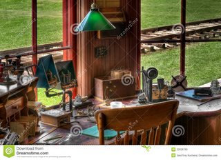
 
Oh, and those railroad tracks are actually, more or less, the ones that start at the WES station in Beaverton, and end abruptly in the middle of Monroe, Oregon.
And also slightly ironic that 120 years ago someone could get passenger service by train down the west side of the Willamette Valley, and now there isn't even bus service. (I presume that there was passenger service, and not just freight service, on those tracks)
The SP Red Electric ran from Portland to Corvallis via Lake Oswego, Newberg and Independence. A second line ran from Portland via Forest Grove and McMinnville to a junction with the Lake Oswego line. Their intention was to extend the wire to Eugene, but in the "meantime" ran a steam powered train daily and a second steam train tri-weekly south of Corvallis. Suver had three electrics daily to and from Portland and Corvallis. See Table 9 in the attached USRRA schedule.

The scheme was to bracket the centrally located Oregon Electric Railway (Hill lines) by electrification of SP branch lines (Harriman lines) on both sides of the Willamette Valley. World War I stopped this work and highway improvements quickly brought an end to the Red Electric. Until 1967, a Pacific Motor Trucking Highway Post Office ran on US99W with the numbers of the last Red Electric trains. Tri-Met Rte 57 is a direct corporate descendant of the Red Electric.

My dad never rode the Red Electric, but he can remember their modern looking steel cars on SW 4th Avenue in Downtown Portland and on Track One in Union Station.
 

Attachments

  • 1919 SP Shasta Route Time Tables.pdf
    4.2 MB
One clarification: while Portland supported the idea of an urban growth boundary, as did Eugene, it was done by state law.

One amusing aside: Tri-Met's taxing and service area originally was the three Oregon metro counties (Clark County in Washington was the fourth in the then SMSA). They were stormed by outraged rural and exurban businesses for including areas unlikely to get immediate service and so the boundaries were shrunk. In the same early 70's, Lane Transit District adopted that region's urban growth boundaries as their district for taxation and service. They were stormed by outraged rural and exurban residents for not being interested in serving them.

One add-on regarding Washington County: Tri-Met's west side line to Hillsboro runs on the former Oregon Electric Railway Forest Grove branch rather than on the then more populated SP Red Electric Forest Grove / Tillamook line. The reason was to encourage the development that was foreseen into areas which could be built as Transit Oriented Development. The SP line runs through old-style sprawl along the state highway.
 
Back
Top