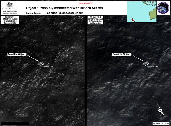
Now it is coming out that Inmersat had predicted within two days of the crash that it is most likely somewhere in the South Indian Ocean. See:
http://gma.yahoo.com/satellite-company-says-predicted-missing-planes-location-10-224715287--abc-news-topstories.html
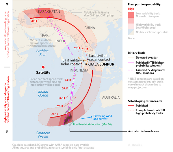
The best projected path calculations diagram I have seen so far is this one:
I can't find a good online article to provide an URL for, but it is becoming clear that the last location being in Southern Indian Ocean as opposed to somewhere in China/Kazakstan is supported by the satellite ping sequence. It is not merely based on the assumption that any plane flying through Indian, Pakistani and Chinese airspace would have been detected. I read the analysis in an article and it is pretty convincing, and is apparently the reason that
Inmarsat has been convinced since day 2 after the crash that the plane is in south Indian Ocean. That advice was apparently ignored by the Malaysian authorities back then.
Apparently it is the US NTSB and the Australians that started working based on that information on their own independent of the Malaysians, and when the Malaysians would not budge someone started strategic leaks about the satellite pings. And as we know, what followed, followed. Pretty strange if you think about it.
Of course all this does not mean that anything will be found soon. That is an entirely different kettle of fish given the high winds a strong ocean currents in that area of the Indian Ocean. Normal folks apparently try to avoid that area like the plague, if they can help it.
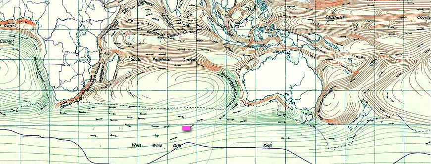
Here is a nice chart of the ocean currents, with the search area roughly marked in pink:
:
The currents are important since if they do find floating debris associated unequivocally with the aircraft in question then they will need the current information to compute back to the location of crash from the location of debris, so as to know where to look at the bottom of the sea 2 to 3 miles down for the rest of it.
The computations of where it could have come down to be more precise would have to take both fuel and wind direction and speed at the altitude flown. The wind direction at various altitudes are roughly known at that time, but altitude flown is not so at best the computations would be a rough estimate properly fit with the intercepts with the distance from satellite rings, based on ping times, constrained by the ground speed range of the plane. It is a fascinating curve fitting problem, if you think about it.
Also BTW it is not just current, but surface winds that would have an impact on where the floating debris lands up. So just using ocean current info for the computation is not enough, and might lead one widely astray.
Of course until they find something, anything, all the analysis of ocean currents and surface winds in the area is somewhat moot..


